 Southern Interior - Hwy 97C
Highland Valley Road - N
Highway 97C at Highland Valley Road between Merritt and Ashcroft, looking north.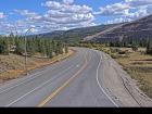
Highland Valley Road - S
Highway 97C at Highland Valley Road between Merritt and Ashcroft, looking south.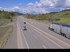
Aspen Grove - N
Highway 97C (Okanagan Connector) at Highway 5A junction near Aspen Grove, looking north.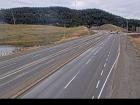
Aspen Grove - S
Highway 97C (Okanagan Connector) at Highway 5A junction near Aspen Grove, looking south.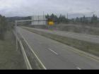
Pothole Lake - W
Highway 97C (Okanagan Connector) about 7 km east of Aspen Grove near Pothole Lake, looking west.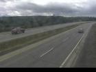
Pothole Lake - E
Highway 97C (Okanagan Connector) about 7 km east of Aspen Grove near Pothole Lake, looking east.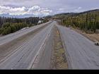
Elkhart - W
Highway 97C (Okanagan Connector) about 25 km east of Highway 5A and Highway 97C junction, looking west.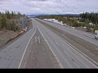
Elkhart - E
Highway 97C (Okanagan Connector) about 25 km east of Highway 5A and Highway 97C junction, looking east.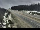
Pennask Summit - W
Highway 97C (Okanagan Connector) about 74 km west of Kelowna, looking west.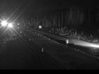
Pennask Summit - E
Highway 97C (Okanagan Connector) about 74 km west of Kelowna, looking east.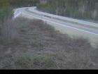
Brenda Mine - W
Highway 97C (Okanagan Connector), about 22 km west of Highway 97 and Highway 97C junction, looking west.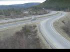
Brenda Mine - E
Highway 97C (Okanagan Connector) about 22 km west of Highway 97 and Highway 97C Junction, looking east.


