 Southern Interior - Hwy 5 (Coquihalla)
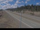
Walloper
Highway 5 about 30 km south of Kamloops, looking south.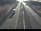
Hwy 5 at Hwy 97D northbound
Highway 5 at Exit 366 Logan Lake/Lac le Jeune Road, looking northbound along Highway 5.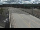
Hwy 97D at Hwy 5 - NE
Highway 97D (Logan Lake/Lac le Jeune Road) at Highway 5, looking northeast.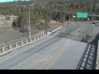
Hwy 97D at Hwy 5 - SW
Highway 97D (Logan Lake/Lac le Jeune Road) at Highway 5, looking southwest.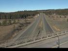
Hwy 5 at Hwy 97D southbound
Highway 5 at Exit 366 Logan Lake/Lac le Jeune Road, looking southbound along Highway 5.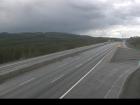
Helmer Lake
Highway 5 about 24 km north of Merritt at Helmer Interchange, looking north.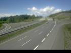
Comstock - N
Highway 5 about 15 km south of Merritt at Comstock Road, looking north.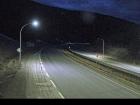
Comstock - S
Highway 5 about 15 km south of Merritt at Comstock Road, looking south.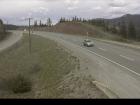
Larson Hill - N
Highway 5 about 36 km south of Merritt at Larson Hill, looking north.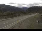
Larson Hill - S
Highway 5 about 36 km south of Merritt at Larson Hill, looking south.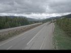
Mine Creek
Highway 5 southbound at Mine Creek Road, looking south.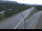
Britton Creek - N
Highway 5 at Britton Creek Rest Area northbound turnoff, looking north.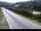
Britton Creek - S
Highway 5 at Britton Creek Rest Area northbound turnoff, looking south.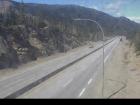
Coquihalla Lakes - N
Highway 5 about 61 km south of Merritt, looking north.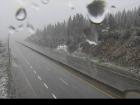
Coquihalla Lakes - S
Highway 5 about 61 km south of Merritt, looking south.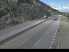
Coquihalla Summit - N
Highway 5 about 7 km north of Zopkios Brake Check, looking north.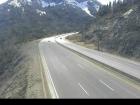
Coquihalla Summit - S
Highway 5 about 7 km north of Zopkios Brake Check, looking south.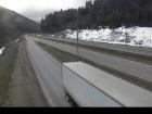
Zopkios Southbound - N
Highway 5 southbound at Zopkios Rest Area near the Coquihalla Summit, looking north.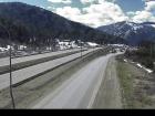
Zopkios Southbound - S
Highway 5 southbound at Zopkios Rest Area near the Coquihalla Summit, looking south.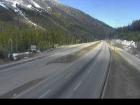
Zopkios Northbound - N
Highway 5 northbound at Zopkios Rest Area near the Coquihalla Summit looking north.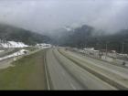
Zopkios Northbound - S
Highway 5 northbound at Zopkios Rest Area near the Coquihalla Summit looking south.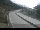
Coquihalla Great Bear Snowshed - N
Highway 5 at the Great Bear Snowshed, looking north.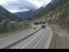
Coquihalla Great Bear Snowshed - S
Highway 5 at the Great Bear Snowshed, looking south.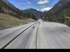
Box Canyon - N
Highway 5 near Box Canyon Chain Up, looking north.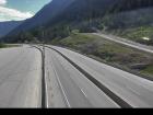
Box Canyon - S
Highway 5 near Box Canyon Chain Up, looking south.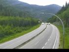
Portia - N
Highway 5 at the northbound Portia Chain Up, looking north.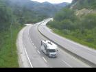
Portia - S
Highway 5 at the northbound Portia Chain Up, looking south.


