 Southern Interior - Hwy 3A
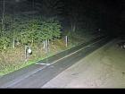
Glade Ferry Terminal - N
Highway 3A at Glade Ferry Road, looking north at west side ferry line up.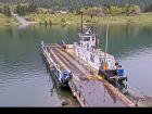
Glade Ferry Terminal - W
Highway 3A at Glade Ferry Road, looking at ferry landing on west side of river.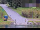
Glade Ferry Terminal - E
Highway 3A at Glade Ferry Road, looking at ferry landing on east side of river.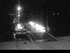
Harrop Ferry Landing northbound
Harrop Ferry Landing on the south side of Kootenay Lake, looking north.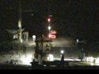
Harrop Ferry Landing North View
Harrop Ferry Landing on south side of Kootenay Lake, looking at the north side landing.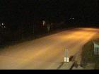
Harrop Ferry North Landing
Harrop Ferry Landing northbound line-up, looking south.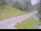
Balfour Ferry Approach - NE
Highway 3A and Highway 31 at Balfour ferry terminal entrance near Ferry Landing Road, looking northeast.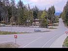
Balfour Ferry Busk Road Parking
Highway 3A and Highway 31 at Busk Road near the Balfour ferry terminal, looking at ferry parking lot.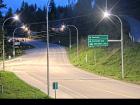
Balfour Ferry Approach - SW
Highway 3A and Highway 31 at Balfour ferry terminal entrance of Ferry Landing Road, looking southwest.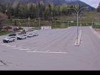
Balfour Ferry Terminal
Balfour ferry terminal, looking north towards Highway 3A.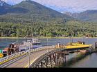
Balfour Ferry Ramp
Balfour ferry terminal, looking south at ferry loading ramp.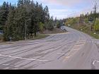
Kootenay Bay Ferry Landing
Highway 3A at Kootenay Bay Ferry Landing, looking northeast.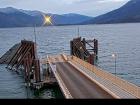
Kootenay Bay Ferry Ramp
Highway 3A at Kootenay Bay Ferry Landing, looking southwest.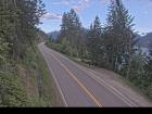
Sanca Creek
Highway 3A about 1.6 km south of Sanca Creek Bridge, looking south.


