 Lower Mainland - Hwy 1 (Horseshoe Bay to Lynn Valley)
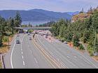
Horseshoe Bay - W
Highway 99 at Highway 1 ramp to Horseshoe Bay, looking west.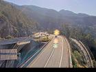
Horseshoe Bay - E
Highway 99 at Highway 1 ramp to Horseshoe Bay, looking east.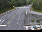
Cross Creek - N
Highway 1 at Cross Creek Road / 15 Street exit in West Vancouver, looking north.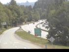
Cross Creek - E
Highway 1 at Cross Creek Road / 15 Street exit in West Vancouver, looking east.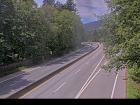
Hwy 1 at Hadden Drive Ramp - W
Highway 1 at Hadden Drive off-ramp for Taylor Way, looking west.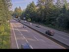
Hwy 1 at Hadden Drive Ramp - E
Highway 1 at Hadden Drive off-ramp for Taylor Way, looking east.
Capilano - N
Highway 1 (Upper Levels Highway) at Capilano Road, looking north.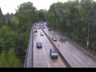
Capilano - W
Highway 1 (Upper Levels Highway) at Capilano Road, looking west.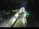
Capilano - E
Highway 1 (Upper Levels Highway) at Capilano Road, looking east.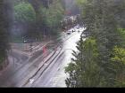
Capilano - S
Highway 1 (Upper Levels Highway) at Capilano Road, looking south.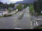
Westview - N
Highway 1 (Upper Levels Highway) at Westview Drive, looking north.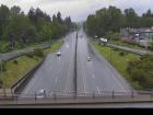
Westview - W
Highway 1 (Upper Levels Highway) at Westview Drive, looking west.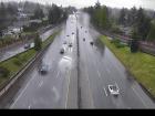
Westview - E
Highway 1 (Upper Levels Highway) at Westview Drive, looking east.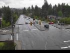
Westview - S
Highway 1 (Upper Levels Highway) at Westview Drive, looking south.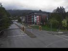
Lonsdale - N
Highway 1 (Upper Levels Highway) at Lonsdale Avenue, looking north.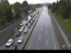
Lonsdale - W
Highway 1 (Upper Levels Highway) at Lonsdale Avenue, looking west.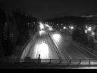
Lonsdale - E
Highway 1 (Upper Levels Highway) at Lonsdale Avenue, looking east.
Lonsdale - S
Highway 1 (Upper Levels Highway) at Lonsdale Avenue, looking south.
Lynn Valley Road - W
Highway 1 near the Lynn Valley Road on-ramp, looking west.
Lynn Valley Road - E
Highway 1 near the Lynn Valley Road on-ramp, looking east.


