 Lower Mainland - Hwy 101 (Sunshine Coast)
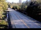
Lund - N
Highway 101 about 8.5 km south of Lund, looking north.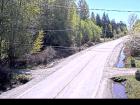
Lund - S
Highway 101 about 8.5 km south of Lund, looking south.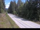
Powell River
Highway 101 near Loubert Road in the qathet Regional District, looking south.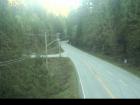
Earls Cove
Highway 101 at Egmont Road, south of Earls Cove on the Sunshine Coast, looking South.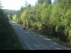
Secret Cove
Highway 101 at Brooks Road on the Sunshine Coast, looking south.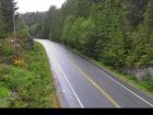
Trout Lake - W
Highway 101 about 10 km north of Sechelt, looking west.
Trout Lake - E
Highway 101 about 10 km north of Sechelt, looking east.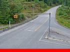
Gibsons Bypass - N
Highway 101 at top of Gibsons Bypass at Stewart Road, looking north.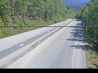
Gibsons Bypass - NE
Highway 101 at top of Gibsons Bypass at Stewart Road, looking northeast.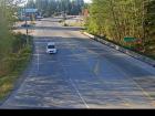
Gibsons Bypass - S
Highway 101 at top of Gibsons Bypass at Stewart Road, looking south.


