-
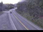
 Vancouver Island / Highway 28
-
Highway 28. Utility work between Nootka Dr and Western Mine Rd for 39.8 km (Gold River to 37 km west of Campbell River). Road closed intermittently. Watch for traffic control. Random 5 minute closures for helicopter to fly materials over near Elk River Bridge. Last updated Thu Sep 11 at 2:33 PM PDT. (DBC-81465)
-
 Nearby Highway Webcams
-
 Nearby Weather Station Reports
-
Forecast Today Tonight 
Campbell River 20 14 
Courtenay 20 14 
Comox 20 14 
Estevan Point 17 13 
Tofino 17 13 
Powell River 21 15 Source: Environment Canada


