-
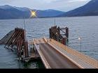
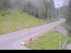
 West Kootenay / Highway 3A Both Directions
-
Highway 3A, in both directions. Utility work between Maia Lane and Lockhart Rd for 8.6 km (18 km south of Kootenay Bay Ferry Landing to 26 km north of Kuskonook). Until Fri Sep 19 at 3:00 PM PDT. Shoulder closed. Removal of old poles. Last updated Mon Sep 8 at 12:22 PM PDT. (DBC-81313)
-
 Nearby Highway Webcams
-
 Nearby Weather Station Reports
-
Forecast Tonight Thu 
Nelson 10 27 
Creston 13 26 
Castlegar 10 27 
Highway 3 - Paulson Summit to Kootenay Pass - - 
Cranbrook 9 25 
Trail 10 27 Source: Environment Canada


